The Hump, Aerial Supply Lifeline, India–China Ferry, 1942
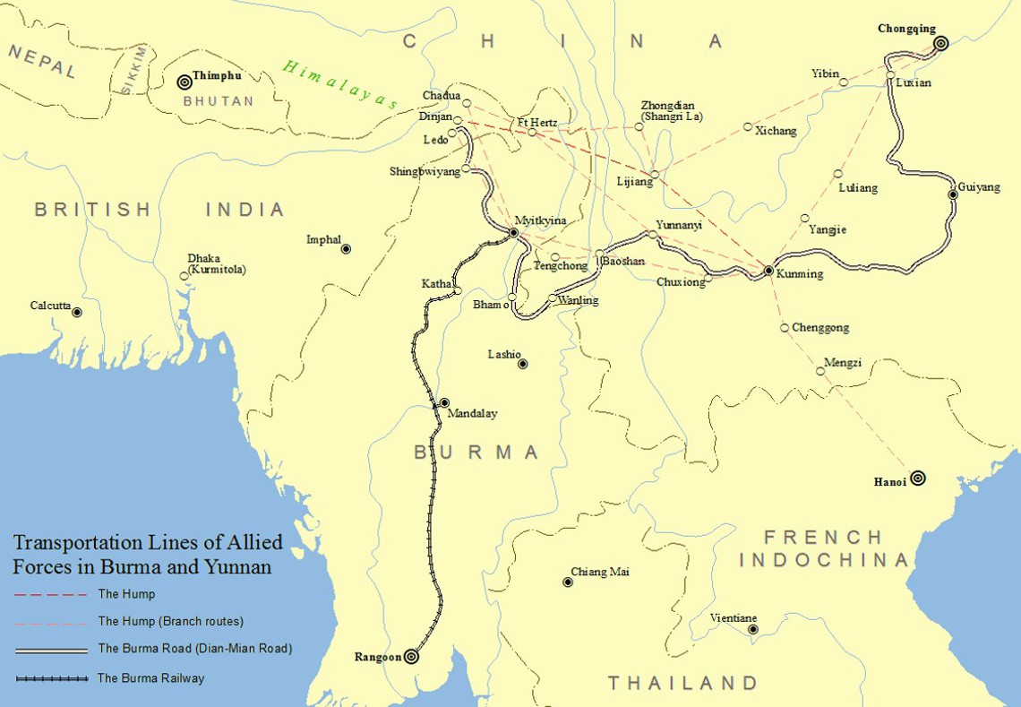
BackgroundDuring World War II, The Hump (officially India–China Ferry) was the dangerous aerial supply route over the eastern Himalayas between India and China. After Japanese forces cut the Burma Road in 1942, the Allies established this air corridor to deliver critical supplies to Allied forces in China resisting Japan.
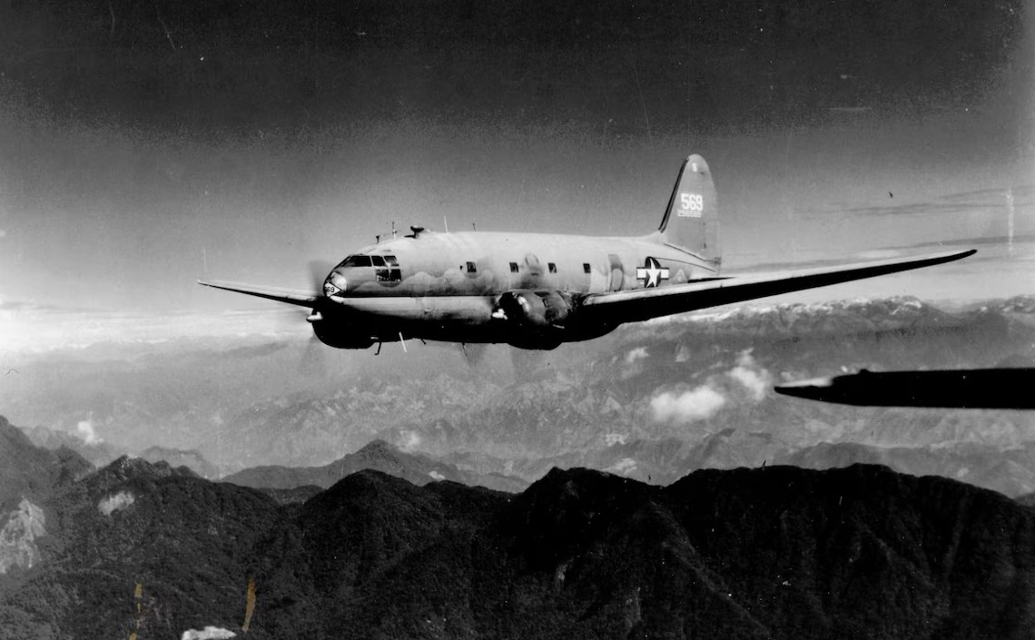
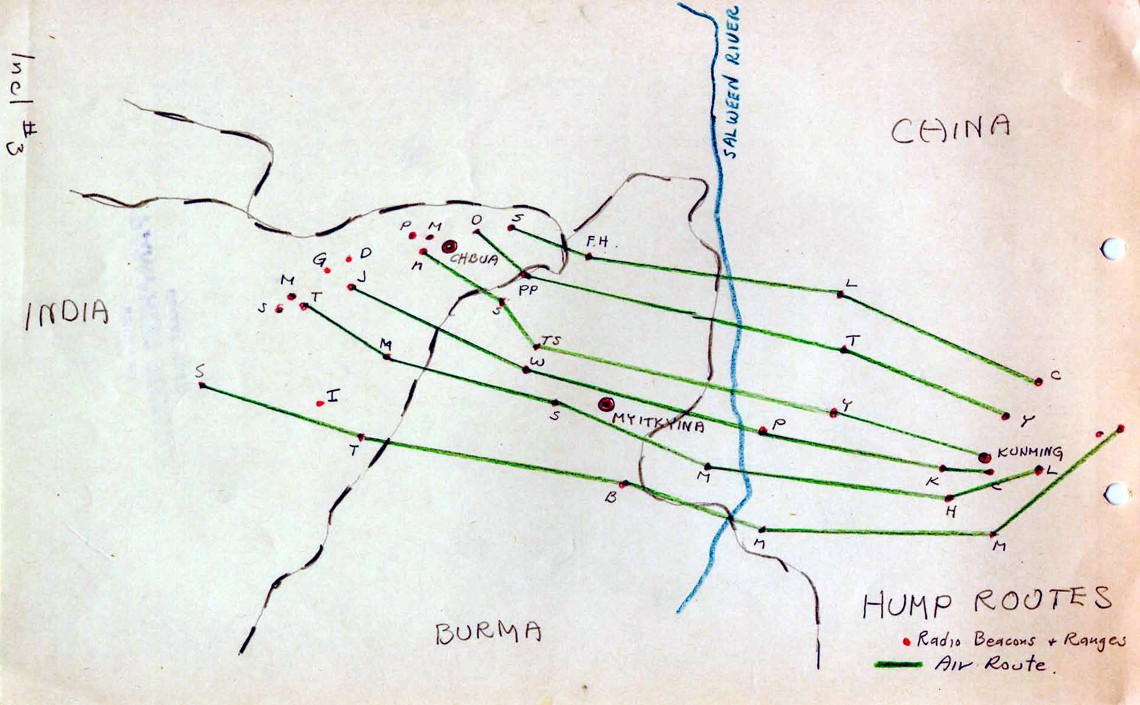
Operated mainly by the U.S. Army Air Forces, the route stretched from Assam, India, to Kunming, China, crossing some of the world’s highest mountains.
The mission faced extreme challenges: unpredictable weather, high altitudes, strong winds, icing, and a lack of navigational aids. Aircraft flew through rugged terrain often over 4500 meters (15,000 feet), with limited engine performance and high risk of failure.
More than 650,000 tons of supplies were transported over the Hump by war’s end in 1945, but at a heavy cost.
Aluminium Alley
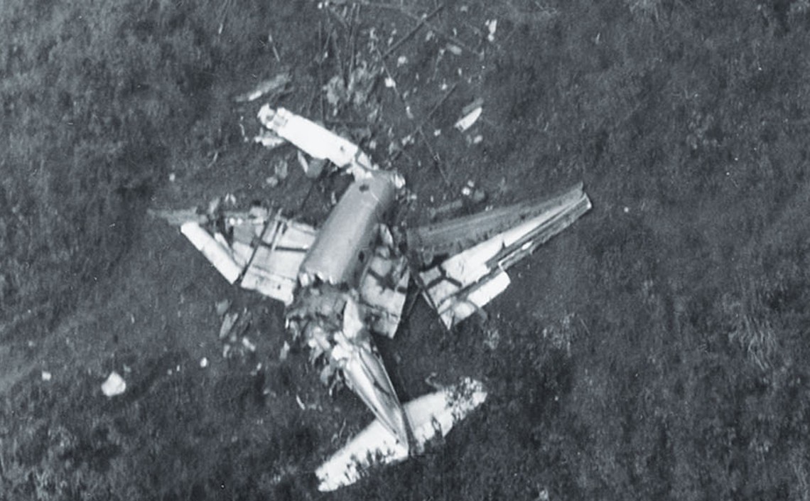
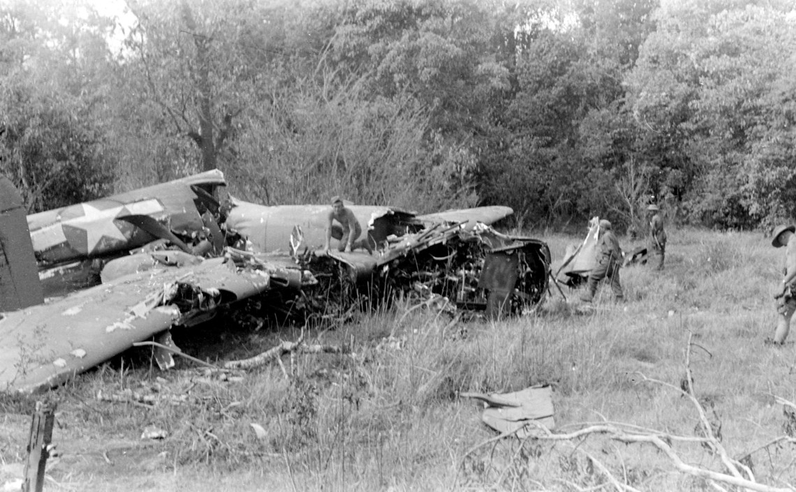
Near 600 aircraft were lost, and around 2,000 airmen died or went missing.
Around 93 wrecks remain unrecovered in the region, making The Hump one of the most perilous and costly airlift operations in history.
Despite the losses, the Hump airlift was a crucial lifeline that sustained the war effort and contributed significantly to the Allied victory in Asia.
The mission
The Hump route holds significant value for our research into Artificial Intelligence methods, including Machine Learning and Deep Learning, for locating wrecks of lost aircraft.
The first key factor is geomorphological: the route crosses one of the most challenging search areas, a combination of very steep and eroded mountainous terrain, covered in dense forests or glaciers, which precludes direct optical searches.
In this case, our research relies on Machine Learning to analyze radar (SAR) and infrared (IR) data over a vast area.
A new Foliage Penetration (FOPEN) algorithm enhances these capabilities. Our mission is to locate accident sites using cutting-edge non-optical FOPEN tools and methods, currently under development.